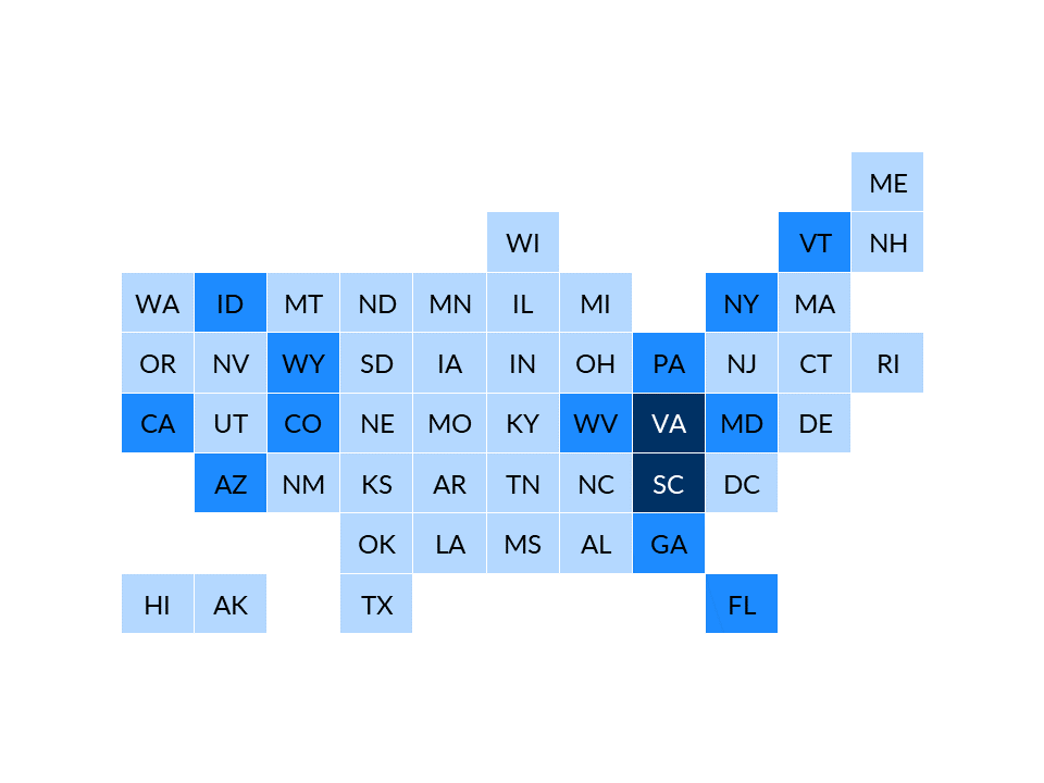
Imagine a traditional geographic map where Texas looks like Texas and Delaware looks like Delaware. No matter how dark you shade in the tiny states like Delaware, they’ll always be dwarfed by larger states like Texas. In traditional geographic maps, our brains are trying to decode information based on both size and saturation. In tile grid maps, each state is the same size and shape. You can use squares, hexagons, or even smiley faces to represent each state.
Resources